Search Term Record
Metadata
Name |
Eustace Smith |
Related Records
-
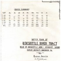
2022.049.001a - Map
Item is a sketch plan of Kokshittle River Tract. Head of Kokshittle Arm - Kyuquot Sound, Rupert District. Part of a series of timber survey linen maps. Item too large for scanner. Only title scanned.
Record Type: Archive
-
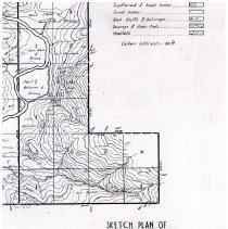
2022.049.001b - Map
Item is a sketch plan of Kauwinch River Tract. Kokshittle Arm - Kyuquot Sound, Rupert District. Part of a series of timber survey linen maps.
Record Type: Archive
-
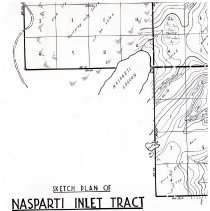
2022.049.001d - Map
Item is a sketch plan of Nasparti Inlet Tract. Partial map. Part of a series of timber survey linen maps.
Record Type: Archive
-
2022.049.001e - Map
Item is a sketch plan of Battle Bay Tract. From Battle Bay, to Mouth of Ououkinsh Inlet, to Rupert District. Part of a series of timber survey linen maps.
Record Type: Archive
-
2022.049.001f - Map
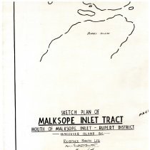
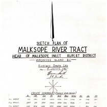
Item is a sketch plan of Malksope Inlet Tract. Mouth of Malksope Inlet - Rupert District. Part of a series of timber survey linen maps.
Record Type: Archive
-
2022.049.001g - Map
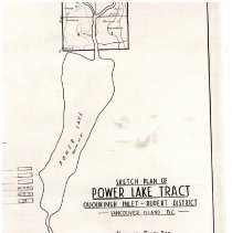
Item is a sketch plan of Power Lake Tract. Ououkinsh Inlet - Rupert District. Part of a series of timber survey linen maps. Item too large for scanner. Only title scanned.
Record Type: Archive
-
2022.049.001h - Map
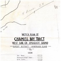
Item is a sketch plan of Chamiss Bay Tract. West side of Kyuquot Sound, Rupert District.
Record Type: Archive
-
2022.049.001i - Map
Item is a sketch plan of Malksope Inlet. Head of Malksope Inlet, Rupert Distrct. Part of a series of timber survey linen maps. Item too large for scanner. Only title scanned.
Record Type: Archive
-
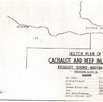
2022.049.001j - Map
Item is a sketch plan of Cachalot and Deep Bay Tract, Kyuquot Sound-Nootka District. Part of a series of timber survey linen maps. Item too large for scanner. Only title scanned.
Record Type: Archive
-
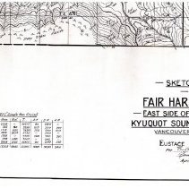
2022.049.001k - Map
Item is a sketch plan of Fair Harbor Tract. East side of Tahsish Arm - Kyuquot Sound, Rupert District. Part of a series of timber survey linen maps. Item too large for scanner. Only title scanned.
Record Type: Archive
-
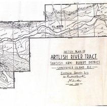
2022.049.001l - Map
Item is a sketch plan of Artlish River Tract, Tahsish Arm - Rupert District. Part of a series of timber survey linen maps. Item too large for scanner. Only title scanned.
Record Type: Archive
-

-
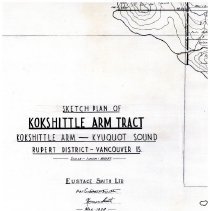
2022.049.001n - Map
Item is a sketch plan of Kokshittle Arm Tract. Kokshittle Arm - Kyuquot Sound, Rupert District. Part of a series of timber survey linen maps. Item too large for scanner. Only title scanned.
Record Type: Archive
-
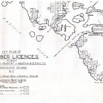
2022.049.001o - Map
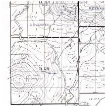
Item is a key plan of 92 timber licenses situated in Kyuquot Sound - Rupert & Nootka Districts. Part of a series of timber survey linen maps. Item too large for scanner. Only title scanned.
Record Type: Archive
-
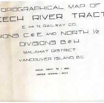
X021.70.098 - Map
Trace of a topographical map of Leech River tract; Esquimalt and Nanaimo (E&N) Railway; Divisions C&E and North 1/2 of Divisions B&H ; Malahat District, Vancouver Island BC. 400ft = 1 inch. Contour interval = 50ft.
Record Type: Archive