Search Term Record
Metadata
Name |
Leech River |
Related Records
-
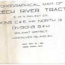
X021.70.098 - Map
Trace of a topographical map of Leech River tract; Esquimalt and Nanaimo (E&N) Railway; Divisions C&E and North 1/2 of Divisions B&H ; Malahat District, Vancouver Island BC. 400ft = 1 inch. Contour interval = 50ft.
Record Type: Archive